Friday, July 23, 2010

Where's Vickie 2010, Volume 9

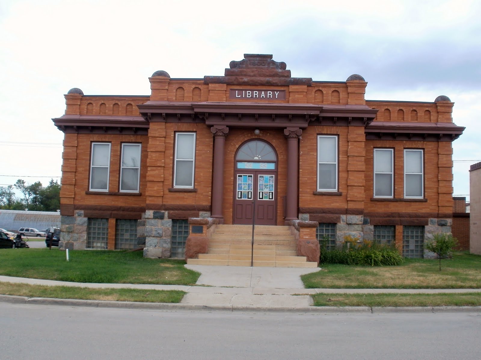
Beautiful library in Mayville ND, on national register of historic places.Beautiful inside, too, but the librarian was a little odd.

ND Sky

A reason to love Fargo

Possibly the coolest bik store ever, in the old railway depot, with it's own cafe and espresso stan. Although the latte was awful, tasted like Farmer Bros. coffee. Bad.

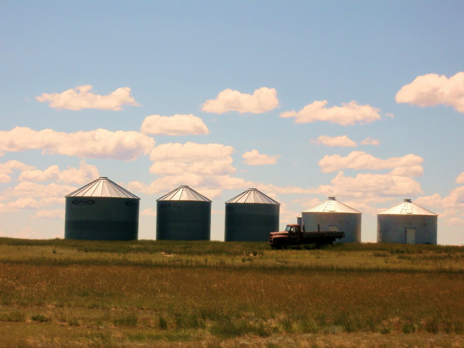
A boquet of wheat (or rye, barley, oats, who can tell??)

The 2nd-tallest manmade structer in the world, from about 8 miles. Field colors look weird because I had to manipulate some to get that tall, skinny tower to show up

No, this is not a joke. Water to the north goes to Hudson Bay, to the south to the Gulf of Mexico.

Day 30 - July 19th - Devils Lake, ND
80 miles, 1600 ft cumulative elevation gain
80 and sunny - perfect biking weather!

Too tired to write today.

Day 31 - July 20th - Carrington, ND
49 miles, 740 ft cumulative elevation gain
75 and sunny - perfect biking weather!

I really shouldn’t have ridden yesterday, or at the very least I should’ve sagged the last 30 miles. All that kept me going for those last miles was the thought of a cold beer, and then when I got in, my room wasn’t ready, and we’re staying in an “alcohol free” hotel on a “dry” Indian reservation. And no espresso, either. If you’re gonna have a casino, a casino for god’s sake, without alcohol, shouldn’t you at least have good coffee????? Still, several of us sat out in the grass and surreptitiously sipped our various illegal beverages (that’s grape juice, right? Or apple juice?) until rooms were ready. I went to bed last night thinking, I don’t care if I ever see another bike, or another bike rider, for that matter. Maybe I’ll just fly home from Fargo.

Not to worry, by this morning, I was refreshed and ready to keep on riding. Although I do think I will cancel out on riding CANDISC. This is another big (hundreds of people) week-long group ride that I signed up for, which would circle back near some of the places I’ve already ridden near Minot. I don’t think the scenery would be much different from what I’ve already seen, it’s back near the oil fields with all that truck traffic, it’s near where Barbara got hit, and I’m just tired of being around big groups. So my current plan is to spend a few days in Fargo, until I’m bored, then head on east into Minnesota in hopes of finding a quiet lake to camp by until I meet up with friends on August 9th for the reunion of the 2005 Southern Tier group.

We have a 92-mile day scheduled for tomorrow, but I’ve already decided I’m riding 60 of it at the most. The day after that will be our last, 60-mile, day into Fargo. There I will spend 2 or 3 nights luxuriating at the Radisson, and (hopefully) another night or two at a friend’s house, before taking off on my own.

Yesterday’s ride was nice enough, it was just too long. Fields of corn, beans, grain, and hundreds of small ponds surrounded by cattail. For about 10 miles at the end of the day, we rode along Devil’s Lake, the largest natural body of water in North Dakota. I was sure this must be a man-made lake, but it turns out that some 3800 square miles drain into it, with NO outlet! So, it has a rather high salinity and high nutrient content (I imagine made even higher by fertilizer and cattle from the surrounding farmlands), which explains the rather unpleasant odor and also the opaque, green-paint look of the water. I would NOT want to swim here, or even boat for that matter, although it seems to be a big recreational draw and is popular with fishermen. (Don’t think I would eat the fish either, thank you.)

There have been problems with the lake flooding surrounding farmlands in recent years, and right now the lake seems only an inch or two below road level. This has lead to proposals to drain it into surrounding rivers, but many environmental questions remain about draining a salt lake into fresh rivers (and I have some trouble understanding this anyway, because don’t the rivers drain into the lake????), invasive species, etc. All in all it sounds like a very poor idea to me.

Along the lake there was an actual forest, the first we’ve seen since leaving Glacier. It was nice to see trees again, mostly oak.

Accommodations last night were at another Indian casino, this time the Sioux. No blackjack for me this time.

But today dawned bright and clear, a very pleasant and easy ride. At one point we passed a sign that read “Continental Divide: Elev. 1619”. Huh??? I thought we passed that way back in western Montana? Turns out this is the Laurentian divide, north-south instead of east-west. On the north side, water drains into the Red River and eventually into Hudson Bay. To the south, into the Missouri and on to the Mississippi and the Gulf of Mexico.

Lynn waved me down at a little town along the way, saying “Have you ever had coffee at a taxidermy shop before?” Inside the Wild Things Taxidermy & Spicy Roadkill Café, sure enough there were many stuffed wild things (bear, cougar, deer, antelope, elk, lynx, otter, ducks, fish, all for sale) AND coffee and vittles. The café is a volunteer effort, open only 11am-1pm, to raise money to convert a local old schoolhouse into a hunters lodge, to bring more business to the town. 20 or so women contribute to this, calling themselves The Sisterhood of the Traveling Crockpot. They told us they cook with the finest wine, and sometimes they even add it to the food!

Day 32 - July 21st - Mayville, ND
0 miles, 0 ft cumulative elevation gain
75 and sunny - perfect biking weather!

This morning I did a “bump-up”, riding about 50 miles in the van, to our lunch stop, intending to ride after lunch. But during lunch my enthusiasm dwindled, and the women who were riding said it was long, and boring, so I just stayed in the van for the rest of the day.

Day 33 - July 22nd - Fargo, ND
59 miles, 242 ft cumulative elevation gain
75, cloudy and misty - perfect biking weather!

We rode out of Mayville through a still, misty morning on a flat, and quiet, silky-smooth road. Killdeer and red winged blackbirds, vast ripening fields of wheat and corn, groves of wind-break trees. A soft gray sky like a down comforter, a spritz of skin-softening mist. It was all just lovely.

A few miles into the ride I notice this impossibly tall, straight, skinny structure away off in the distance. What in the world it can it be?… It looks totally impossible to me, like it extends right up into the clouds. Is it some sort of mirage? It can’t be a radio tower, it can’t be a tower at all because I see no lights flashing on it. For awhile, since the morning is so still, I convince myself that it’s a column of smoke. I can hardly take my eyes off of it. Then I think, man, could it be a funnel cloud??? As it gets closer, though, it continues to be ramrod straight and 10 miles later I can see guy wires and it’s clear that it is, in fact, some sort of radio tower. I comment to one of the other riders “that thing’s gotta be a half mile tall!” and she pooh-poohs that. Googling later, I find that this is the KVLY-TV tower and is, in fact, the 2nd-tallest manmade structure in the WORLD! Topped only by the Burj Khalifa in Dubai! At 2063 feet, OK, it’s not a half mile tall, but it is nearly four-tenths of a mile. Wow. I am just delighted by this roadside discovery!
Unhappily, after that, the wind picked up, and soon we were heading straight into what must be a 20 mph headwind. The last 25 miles into Fargo were drudgery, but WE MADE IT!!!!!

I am now happily ensconced on the 8th floor of the Radisson. It’s wonderful to be in a city again! The whole population of North Dakota is around 600,000, and 1/6 of that is here. And there are trees here! Lot’s of ‘em, more than I’ve seen in one place since leaving the mountains. I’m sitting with my feet up, watching wind turbines in the distance, watching trains go by below. The room here is divine, downtown Fargo is delightful, and I will luxuriate here for 3 nights

Sunday, July 18, 2010

Where's Vickie 2010, Volume 8

HEre are several videos of the ferocious wind (tailwind and sometimes crosswind) that we rode in for several days. be sure and click the "expand to full screen" button for the full effect. And turn up the volume!


The center of North America

Dinner in a teepee, Minot ND

Dinner in a teepe, Minot ND

Me and the troll at the Scandinavian Heritage center, Minot

Beautiful replica of medieval Norwegian church, Minot

Typical North Dakota scene

Escape from Montana!e

Long road, North Dakota

Flax and Canola in bloom

Day 25 - July 15th - Williston, NORTH DAKOTA!
59 miles, 1800 ft cumulative elevation gain
75 and sunny with a tailwind- perfect biking weather!

And WHAT a tailwind, a howling 20-30 mph all day! A bout half of us actually did an optional extra 18 miles across the wind, to see the confluence of the Yellowstone and Missouri rivers. The scenery made it well worth it - rocky hills, curvy back roads -- and I actually thought riding in the crosswind was fun. Kinda like playing in the surf, waiting to go up against the next “wind wave”.

We have now entered an area where there’s a big oil boom going on, and the truck traffic that goes with it. We are awaiting to hear how we’ll be re-routed tomorrow because of way too much traffic (the paper reports something like 6000 vehicles per day) on the scenic, narrow, no-shoulder road that we were supposed to be on. I suspect we’ll be back on good ol’ US 2 again.

We’ve finally made it out of Montana ! The state line margarita celebration is being postponed thought, due to it being so windy that our cook can’t keep the fire lit in the chuck wagon tonight, so we’re going to the local restaurant for dinner

I am not impressed with our digs tonight. Williston is the biggest town we’ve been in since I can’t remember when, so I was looking forward to the benefits of a city (at least an espresso), but we are on the outskirts where there’s nothing in sight but the hotel, a gas station, and “Gramma Sharon’s family restaurant”. And there are big trucks keeping their engines running, just outside my window. OH well, 2 more days to our rest day in the big metropolis of Minot.


Day 26 - July 156h - New Town, ND
69 miles, 1800 ft cumulative elevation gain
75 and sunny with a tailwind- perfect biking weather!

That tailwind had us flying again today … 70 miles in 4 hours! It was a blast! We rode the whole day on US 2, now a 4 lane highway, most of the way with a good 10 foot smooth shoulder. That got us to the town (which consisted of 2 bars, a café, and a tastee freeze) of Stanley, where the van shuttled us on another 35 miles to New Town, on the shoulderless road with all the oil-construction traffic.(the local paper says 6000+ vehicles per day!) It is truly amazing how many oil wells are being drilled here…hundreds either already pumping or just being drilled; We passed lots of temporary housing, and all the motels closer to our route are booked with oil workers.

So, tonight we are at the 4 Bears lodge and casino, run by the Mandan, Hidatsa, and Arikara tribes. It’s luxurious digs compared to where we’ve been lately. Right on huge and, to my mind, not very scenic Lake Sakakawea. The view is clouded by the tragic story of how the flooding of the fertile valley here basically ended the way of life of the tribes. We have ridden through so many huge Indian reservations out here, the tragedy of the decimation of their culture, and loss of lives, has really struck me. I want to do a lot of reading on native American history when I get home.

Well, I assuaged my white person’s guilt a tiny bit by giving back $25 at the casino tonight. I learned how to play blackjack, which turns out to be a lot more fun than just feeding quarters into the slots. It took me more than an hour to lose $20 (I was actually ahead $20 at one point!), and then about 5 minutes to feed $5 to the slot machines without a single hit. Disappointing because the slots here still use actual coins, and the only reason I would ever play slots is for the love of that clink of coins into the tray when you cash out.

Tomorrow morning we will get shuttled back the 35 miles to Stanley to resume our ride into Minot.

Day 27 - July 166h - Minot, ND
52 miles, 820 ft cumulative elevation gain
90 and sunny - perfect biking weather!

I would swear that today was hillier than yesterday, but I guess it was just the lack of tailwind.

There can surely be no better way to comprehend the immensity, and the emptiness, of the great plains than by bicycle. Minot, with a population of about 36000, is the largest city we’ve been in since, well, it’s the largest city on the trip so far. (Holy cow, I see that Fargo is almost 100,000... I can hardly imagine….)

We passed many large fields of flax (blue) and canola (yellow) in full bloom. It was a beautiful ride.

Sadly, the horrific accident at the end of today overshadows everything else. One of our riders was hit by a truck and died at the scene. She was riding by herself at the time, so we will never know exactly what happened. Needless to say, we are all pretty shaken up.

Day 28 - July 176h - Minot, ND
rest day
80 and sunny - perfect biking weather!

We are all still shaken up from yesterday’s accident, and I imagine we will be for a long time. Four of our group have elected to end their ride here. The rest of us will ride on tomorrow, dedicating our last five days to our fallen friend. I can only think that she would have wanted us to go on enjoying our trip, so that’s what I aim to do.

Several of us took a taxi into downtown Minot today. There’s a very nice Scandinavian Heritage museum, but not much else to recommend the place. Although we did find an espresso place.

Day 29 - July 186h - Rugby, ND
71 miles, 770 ft cumulative elevation gain
75 and sunny - perfect biking weather!

An easy, flat ride with a tailwind. Once again I averaged 15 mph for the day, and even had energy left to ride an extra mile or two into downtown Rugby (where there was really nothing to see anyway) at the end of the day.

We are starting to get into cornfields now. And in between, acres an acres of wetlands. Here’s a piece of trivia for you: North Dakota has more surface water than any other state. Not hard to believe: as you ride through here, there’s nearly always a pond in sight. And it seems like there are more cattails than wheat.

We all wore our WomanTours jerseys and left Minot in one big group today (which is very unusual for us), and then rode mostly in sight of each other all day. We’re all still feeling a bit insecure about traffic, and glad that tomorrow we will leave US 2 behind and be on back roads most of the day.

Rugby bills itself as the “geographic center of North America”. So I guess as of tomorrow we will officially be in the east?

Tuesday, July 13, 2010

Where's Vickie 2010, Volume 7

This is a video of the montana wind... which was unfortunately NOT a tailwind on this day.
curvy hayfield

The bike shop in Glasgow MT. Only sign is the bike and the piece of paper visible in the window. Unfortunately not open

It's a wonder no one wiped out on this maze of cracks in the road, about an inch deep and just wide enough to fit a bike tire. This went on for several miles

This pretty little house-sized building is apparently really a working Coca Cola bottling company in the tiny town of Glasgow, MT

Bikes lined up before breakfast in Wolf Point, MT

This is my attempt to capture the beauty of the alfalfa lining the highway.

Day 21 - July 10th - Malta, MT 88 miles, 660 ft cumulative elevation gain 80, sunny and windy - perfect biking weather! Last night I worried about whether I would want to complete today, thinking I might just hop in the sag wagon at about mile 60. But this was surely the easiest 88 miles I’ve ever ridden.. The weather cooperated by not getting too hot, and we had a marvelous tail wind for the first 50 miles: I averaged 15mph, unheard of for me. The terrain was very different today. No more vast fields of wheat. We rode all day within sight of the Milk river and, what’s more, within sight of actual trees! Instead of wheat we had lots of hay fields. Where are the cows that one would expect with them? At about mile 50 the terrain changed again, to a wide river bottomland, dotted with small ponds and BUGS. You literally could not stop - or even slow down - without being immediately surrounded by a cloud of what I think are black flies, which I remember (and not fondly) from northern Michigan summers. Luckily that only lasted for about 20 miles, and then the wind picked up, and changed to a cross wind, blowing all the bugs away and keeping us cool. (Note that positive spin!) I felt like I was leaning about 20 degrees to the left to ride with it, and sincerely hope that does not turn into an actual headwind tomorrow. C’mon, prevailing westerlies! Day 22 - July 11th - Glasgow, MT 0 miles, 0 ft cumulative elevation gain 75 and drizzly- perfect biking weather! I woke up this morning still very tired and achy from yesterday, so decided to skip riding today. Got into the little town of Glasgow a couple of hours before the motel room was even ready. When we first got to the hotel, it seemed like everyone in town was at the hotel restaurant for the Sunday afternoon buffet. Not much else to do here on a Sunday. Although it is still apparent that the town was once fully alive, with quite a few nice old brick 3-story buildings, it is all but dead now -- especially on a Sunday. Still, it’s the county seat and there are TWO espresso places in town, and one nice looking restaurant -- all closed today. About half the stores are empty, and the only one open for business today other than gas station mini-marts was Ace Hardware. Wikipedia says Glasgow was 4 times this size in the 60’s, due to a nearby air force base that was used in the Viet Nam war. I also must note that today we drove through Saco, which held the record for making the world’s largest hamburger in 1999 --- 6040 pounds, which is about 30 pounds for every man, woman, and child in town. Hey, cut me some slack! It’s been a boring afternoon! I tried to watch the world cup final game for awhile, but my god, how long can you watch a game with no score???? (my limit was about 60 minutes….) Tonight is one of those perfect, crystal-clear, soft, warm evenings you get after a summer rain. I really wanted to just sit outside until sunset, but I lasted for all of about 10 minutes before the mosquitoes found me and I had to retreat to the safety of my room. Day 23 - July 12th - Wolf Point, MT 53 miles, 750 ft cumulative elevation gain 90 and sunny- perfect biking weather! We started out racing a big thunderstorm off to the south this morning, but it passed us by with no problems. I’d like to know where the heck these “prevailing westerlies” are, because we rode into a stiff headwind / crosswind all day. Probably a blessing, as that kept the temperature down and the bugs away. I added a layer of Cutter’s over the sunscreen this morning, which probably helped some, too. We actually got off of US 2 for about 30 miles today, on nice back roads through beautiful, sweet smelling fields of alfafa, some freshly cut, some just about ready. We had our first, and hopefully only, accident of the trip. Lynn and Barbara crashed, Lynn coming away with skinned elbows and Barbara with a split lip.They both seem OK and in reasonably good spirits and I think both will be riding tomorrow. Day 24 - July 14th - Culbertson, MT 57 miles, 910 ft cumulative elevation gain 75 and sunny with a tailwind- perfect biking weather! What a great ride! We finally found the prevailing westerlies, so it was more of a flight than a ride: 57 miles in 4 hours. For several days, we’ve been riding with occasional glimpses of the Missouri river to the south, and today we were right at it’s banks briefly. Lots more hay fields today, and toward the end of the day, a couple of big hills to climb. Once again we were on pleasant back roads for a good part of the day. Today we played group “poker”. Everyone contributed $3 to the kitty this morning and got 5 cards. At each of our two sag stops, we got to draw. Tonight at dinner we’ll see who’s the winner. I’m pretty sure it’s not me, with just a pair of 8’s, aces high.

Friday, July 9, 2010

Where's Vickie 2010, Volume 6

prickly pears in full bloom


grain silos and a nice old truck


one of the last old steam engines, in Havre


someones driveway, with the Sweetgrass hills in the distance


Several of the little towns had these beautiful signs, each one different


I liked this weathered old grain elevator


lots of nothing, as far as the eye can see..


We've seen lots of murals similar to this throughout Idaho and Montana


Day 18 - July 7th - Chester, MT
64 miles, 910 ft cumulative elevation gain
75 and gorgeously sunny - perfect biking weather!

Today was just lovely! Sunshine all the way, and our first day with less than 1000 feet of climbing! We are really in the prairie now, with long, gradual, rolling hills. I rode in my big chain ring nearly all day.

About 20 miles into the ride, we found a very nice little espresso place in the tiny town of Shelby, where I spent close to an hour and ended up buying a painting to have shipped home. This place also had walls full of various homeopathic remedies, big jars of evil looking dark liquids. There were 10 empty bottles of Everclear in the restroom, and I assume that’s the liquid in the homeopathic stuff…which may go a long way towards explaining why so many people claim that homeopathy works…?

In 60 miles the only other signs of civilization were the “towns” of Dunkirk, Devon, Galata, Lothair, and Tiber, each of which consisted of a grain elevator and maybe a dozen houses on dirt roads. The Chester museum guide (see below) told me the story behind this: the original steam engine trains had to stop for water every 6 miles, and that’s how the towns originated. Now, there are no regular train stops between Cut Bank and Havre. It looked to me like most of the grain elevators are still in use, though.

The vast wheat and barley fields are beautiful and green, and the sky is huge. We passed a sizeable area of prickly pear cactus, all in full bloom. The mosquitoes are fierce out here, even in the heat of the day, and (I think) black flies in the evening.

We rode on US 2 all day, with reasonably light traffic and a reasonably good shoulder. A half dozen full logging trucks passed heading west, and it makes me wonder where the heck they’re finding the trees, as I saw maybe 5 the whole day. Way off to the north you can see a small mountain range, which the map says is the Sweetgrass Hills. Perhaps there are trees there.

Chester, Montana: I am quite enchanted with this place. I can’t think when I’ve been in a more peaceful or friendlier little town. Walking through town after dinner, folks were actually sitting out on their front porches, and said hi to me when I passed. The retired town doctor rode by on his one-speed and tooted his rubber-bulb horn at me. I spent the better part of an hour at the town museum, where a very nice woman showed me around. Coming back to the hotel, the proprietors were sitting outside an asked me if I wanted a glass of “Hutterite wine”. There are apparently several Hutterite settlements around here (somewhat similar to Mennonites), and they “horse-trade” with them, wine for Coke and such. The wine was sweet and strong, and quite good.

The MX hotel where we are staying tonight is the only hotel in town, and it is one of those fabulously funky places. Every room is different. Some have kitchenettes and separate bedrooms. The “executive suite” has a gold pressed-tin ceiling, and a huge 4-poster bed with a gold-lame bedspread. Our group is taking up the entire hotel; in fact, there is a guy who normally lives here full time who vacated his room so there would be room for us tonight.

All in all, just an excellent day!

Day 19 - July 8th - Havre, MT
60 miles, 1040 ft cumulative elevation gain
80 and gorgeously sunny - perfect biking weather!

Today seemed much harder than yesterday. I think we had a bit of a tailwind yesterday, and a bit of headwind today, though nothing like the strong winds that Montana is infamous for. Kinda hoping for some of those (from the west, please!) over the next week or so.

We had exactly two turns all day: Right, out of the hotel onto US 2, and left, into the hotel in Havre. And sure enough, those railway water-stop towns / grain elevators about every 6 miles: Joplin, Inverness, Rudyard, Hingham, Giltford, Kremlin. The only trees were in the towns or the very few farmhouses, which all seem to be set back about a mile from the highway.

This whole area is referred to as the “Hi-Line”, after the Great Northern railroad which we are riding along. Completed in 1893, it’s still in heavy use, with long trains going by probably twice an hour.

Still, it’s mighty lonely looking out here. Liberty County (Chester, where we were yesterday, is the county seat) has a population of only 2158 people , fewer than it had in1920. That‘s only 1.5 people per square mile, so when our group sweeps through, it‘s a 1700% increase in population! Hill County, where we are now, tops out at under 17000, with more than half of those in the town of Havre. And Philips County, where we’re heading next, stands at about 4600, less than half of its 1920 population. The main reason given for the decrease in population is the increasing mechanization of farming. You see miles and miles and miles of grain fields between anything that looks like a house. I would like to see this area at harvest time.

Havre, by the way, is pronounced “haver”, like “I don’t want ‘er, you can have ‘er”.

The whole 60 miles of highway right-of-way seems to be planted in hay just one or two swaths wide, which has just been cut, lending a very nice perfume to the air.

Day 20 - July 9th - Havre, MT
Rest Day
Hot, dry, and sunny - perfect biking weather!
I walked the mile or so into town this morning before it got too hot. Bought a couple of books and found a latte at the deli in the back of the IGA, where I also finally bought some real coffee (Seattle’s Best) so that I can make non-motel coffee in the mornings. A trip to the local thrift store scored me a sun hat for 50 cents, and I was back here in air-conditioned comfort by early afternoon. Better soak it up today, as we will be riding 92 miles in the heat tomorrow.

Tuesday, July 6, 2010

Where's Vickie 2010, Volume 5

Any idea what these flowers are>

Big field of those flowers, just east of the rockies

Foggy, Rainy Logan Pass

Lake McDonald, Glacier National Park

Looking down at where we came from, from Going TO The Sun Rd.

Going To The Sun Rd, Glacier National Park

I can't resist wildflowers. No idea what they are. Not lupine

Day 14 - July 3rd - Lake McDonald Lodge, Glacier National Park, MT
40 miles, 1000 ft cumulative elevation gain
55 and cloudy with a little rain - perfect biking weather!

Today’s ride was nearly flat and very easy. Our late start made it even easier. Bikes aren’t allowed on the road in Glacier between 11am and 4pm, so we didn’t leave Whitefish until just after noon. I availed myself of the latte stand next to the hotel this morning, and then walked back into town for a late breakfast. And still we were at the gates of Glacier just after 3, with an hour to dawdle in the gift shops and visitor center. Then just a 9 mile ride to the lodge, so there was plenty of time for a nap before dinner.

WomanTours is, for some reason, not allowed to cook out of the van here, so we all got dinner vouchers for the nice restaurant in the lodge. There was about an hour wait to get into it, but we spent it pleasantly in the adjoining bar.

After dinner I sat about by the lake for close to an hour, listening to the Swainson’s Thrush echoing through the trees, and enjoying the mirror-like lake and surrounding mountains. Unfortunately it’s still pretty cloudy so we’re not getting the full impact of the mountains, but they’re sill impressive.

Day 15 - July 4th - Lake McDonald Lodge, Glacier National Park, MT
Rest Day
60 and mostly cloudy - perfect biking weather!

Christine and I took the free park shuttle some miles up the road intending to hike to Avalanche Lake, but by the time we got there it was threatening to rain, so we just got back on the bus and came back. There’s not a lot do to here other than sit by the lake, and the weather is just not cooperating for that.

After dinner tonight I sat down at the piano in the lobby and played for an hour or more, most of the way through a “songs from the movies” songbook. I am certainly not the greatest piano player in the world, but I got a little applause and no boo’s, and a nice man bought me a glass of wine. It was great fun!

We’re all a bit worried about the weather tomorrow, which is predicted to be worse. Climbing over a 6500 foot mountain pass, where there is still 4 feet of snow on the ground, does not sound all that appealing in the rain. I’m about to dig out all my cold weather gear.

Day 16 - July 5th - St. Mary’s Lodge, just outside the east gate of Glacier National Park, MT
40 miles, 3000 ft cumulative elevation gain
37 to 65, rain, clouds, sun, wind - perfect biking weather!

Well, Logan Pass was a piece of cake; most of us thought it was the easiest of the 7 passes we’ve been over. Maybe it’s just because we’re in better shape…?
Because park rules require us to be done with the climb before 11am, we were on the road just after 6 this morning It was a lovely ride through quiet woods and a bit of that liquid “Seattle sunshine”, surrounded by early morning birdsong, After about 10 miles, the climb started. But it’s “only” a 6% grade, and “only” for about 10 miles. Even with the clouds, the views were superb… I imagine on a sunny day it would take a lot longer because I’d be stopping a lot more to gawk.

Near the top we got into thick fog, and then more rain and cold. Stopped at the top just long enough to take a picture of the sign, and then a very chilly descent until we hit the blessed warm sunshine below.

I am quite happy to be done with our major mountain ranges! We have climbed close to 7 miles so far!

We were at our hotel just after noon, but they wouldn’t let anyone check in until 4pm Luckily, they have a very comfortable lounge with a big fireplace, nice bartender … and lattes!

The rooms here are just beautiful, and my room has a deck overlooking the St. Mary’s river. Wish we were here for more than one night.

Day 17 - July 6th - Cut Bank, MT
63 miles, 2400 ft cumulative elevation gain
45 to 70, mostly sunny - perfect biking weather!

We had a hard 8 miles of climbing out of St. Mary this morning, gaining 1000 feet in the first 3 miles. By the top of the climb my altimeter claimed we were back above 6000 feet. It was damp and chilly, really chilly on a long, fast descent from there. Then, at long last, we were truly OUT of the mountains and into rolling prairie. As the Rockies receded into the distance, we coasted down long hills with a (mostly) tailwind into Cut Bank. The mountains are now where I prefer them, just a pleasant backdrop in the distance.

Last night after dinner I performed a little song I worked up, in honor of our rest days. It went over very well, and everyone was singing along at the end. Here are the lyrics, to the tune of “What a Difference a Day Makes“:

What a difference a day makes
24 little hours
Brought my legs back to power
Where there used to be pain

I’ve been pumpin’ up those steep hills
I’ve been poppin’ lots of pain pills
I’ve been riding on sheer will
But I’ve survived to say

What a difference a day makes
When you ride in the van
Once again I’m a fan
Of the Northern Tier

It’s heaven when you
Find lattes on your menu
What a difference a day makes
And the difference is you and you and you and you and you and you and…

What a difference a day makes
You can sleep in for hours
You can take a long shower
And rest your butt all day

Or you can get your muddy bike clean
You can blog about all you’ve seen
You can wash your clothes in a machine
If you’ve got quarters to pay

What a difference a day makes
Now I’m ready to jump on
My bicycle and pump on
Towards our Fargo goal

I feel a great bliss
With such great women to ride with
What a difference a day makes
And the difference is you and you and you and you and you and you and YOU!

Friday, July 2, 2010

Where's Vickie 2010, Volume 4

Along Lake Koocanusa

Lots of these rock walls along Lake Koocanusa


Loading bikes for all of us bailing on the ride to Whitefish


The only moose I've seen so far...


Another excuse for margaritas!


I wish it was me in the picture, but it's Lynn. What a perfect biking picture!


Me with Lake Koocanusa


Kootenai Falls

Lake Koocanusa

Site of the great glacial ice dam... see below for more info

Christine, Vickie, Rebecca and Kit in Sand Point

I couldn't resist this perfect daisy lying on the pavement after rain in Whitefish

Day 10 - June 29th - Sand Point, Idaho
Rest Day!
77 and sunshine - perfect biking weather!

No biking today. Spent the day wandering around this pleasant little tourist town, and napping. I bought a new camera -- 12 mega pixels with a 5x zoom, for less than half the price of my defunct 6-year-old with 8 mp and 3x zoom. It doesn’t have a view finder, but the guy at the camera store says even Canon, the last hold out, doesn’t make view finder cameras any more, and the LCD screen seems reasonably visible even in bright sunlight.

At one store today, I asked the saleswoman if Lake Pend Oreille was a natural lake or dammed. She looked at me strangely and said “ you mean lake Pend-O-Relly?”. I’ve asked another couple of locals and they are unfamiliar with this pronunciation. As to whether it’s a natural lake or not…. Yes, it’s a natural, glacier-formed lake, but made somewhat larger by a damn downstream. This is the largest lake in the northwest, and at 1150 feet, #13 on the list of the world deepest.(holy cow, did you know that Lake Baikal is 5369 feet deep???)

A 98 mile day coming up tomorrow, so I’m off to bed.

Day 11 - June 30th - Libbey, MT
98 miles, 3160 feet cumulative elevation gain
80 and sunshine - perfect biking weather!

Another day where I was barely functional at the end, so I am writing this a day later. And since I am once again barely functional, not sure how descriptive I can be about yesterday.

We went through the Cabinet mountains today. Through, thank god, rather than over. Big, steep, tree-covered mountains all around, but after leaving Lake Pend Oreille, we followed along the beautiful Kootenai river valley all day. The Kootenai is a surprisingly big river.

Not far out of Libbey today we passed the site of the huge ice dam that blocked ancient Lake Missoula. This dam was over 200 stories tall and covered, the sign said, as far as the eye could see. Then occasionally, every few thousand years, it gave way, letting all that water pour out, which is what formed large parts of the landscape in eastern Washington. The area there is sometimes called the “channeled scablands” which makes it sound awful, but it’s really quite beautiful. See from the air, it looks like someone dumped a washtub of water into a Childs sandbox. It’s really quite remarkable, and so hard to even imagine such a cataclysm of water. For more on this quite fascinating story, see
www.glaciallakemissoula.org/story.html

I saw a bear! Just a little black bear, munching on something alongside the road.

Near the end of the day I stopped to see Kootenai falls, well worth a visit. Not a big falls, but a beautiful series of smaller ones, surrounded by rocky shores begging to be sat on in the sunshine. I wish I’d been able to spend a half day there.

Day 12 - July 1st - Eureka, MT
67 miles, 3400 ft cumulative elevation gain
70 and sunshine - perfect biking weather!

We started out in a 48 degree cloudy chill this morning, but by lunchtime were back in the sunshine. This was a very difficult day, perhaps more so than yesterday, through the Purcell mountains. Who knew there were so many mountains???? And now the Rockies are in sight.

Most of the day we were again along the Kootenai River and it’s dammed counterpart, Lake Koocanusa…. A tortured combination of Kootenai, Canada, and USA. Personally I wish they’d just called it Lake Kootenai.

This was some of the most fabulous scenery so far on the trip. We rode on high bluffs above the lake, with sheer rock walls to the right and lake to the left. Visited briefly with a bevy of rock climbers, some of whom were hanging from said walls.

I swear gravity works differently here. Yesterday, and especially today, I found myself having to granny down into my lowest gears on roads that looked flat, or even downhill. Yesterday at the end of the day even though we were riding UP the Kootenai river, we coasted DOWN hill. But the worst was just before getting into Eureka today: it looks like downhill; the town, I swear, is down in a pretty green valley. But you have to pump like hell to get to it.

This is a HARD trip. Strenuous. Tiring. Arduous. Demanding. Exhausting.. I think I’m still having a good time, but I’m too tired to know for sure…..

Day 13 - July 2nd - Whitefish, MT
0 miles, 0 ft cumulative elevation gain
45-70 rain, sun, rain, sun - perfect biking weather!

I rode in the van today, along with nearly half of the group. After riding more than 160 seriously hilly miles in two days, I had trouble getting to sleep last night due to aching thighs, aching feet, aching hands, aching shoulders. I would’ve been another 60 hilly miles today, and the rain this morning was the last straw.

It was SOOOOO nice not to have to rush around getting ready this morning. I got to have 2 leisurely cups of good (aka, NOT Farmer Brothers at the motel ) coffee.

We were in the Whitefish in time for lunch. Many of us bought “Going to the Sun” (which we will be riding up on July 5th ) jerseys at the local bike shop. There’s an art fair going on downtown, which I spent an hour or two at and bought a lovely fused glass plate (being shipped home). Whitefish has a very nice downtown with lots of interesting little tourist-trade places, art galleries, outdoor clothing stores, and the like. And many espresso places… in fact, there’s one in the parking lot of our motel! Good coffee again tomorrow morning!